The Humanitarian OpenStreetMap Team (HOT) and thinkWhere are using open source software, open data and cloud technology to coordinate a global network of volunteers providing mapping for disaster preparation, response and recovery.
Challenge
US-based charity, HOT is one of the world’s most technically effective humanitarian groups, specialising in collaborative mapping. Timely coordination of the activities and contributions of more than 60,000 international volunteers is a complex task which requires coordination, prioritisation and distribution of crucial data.
Solution
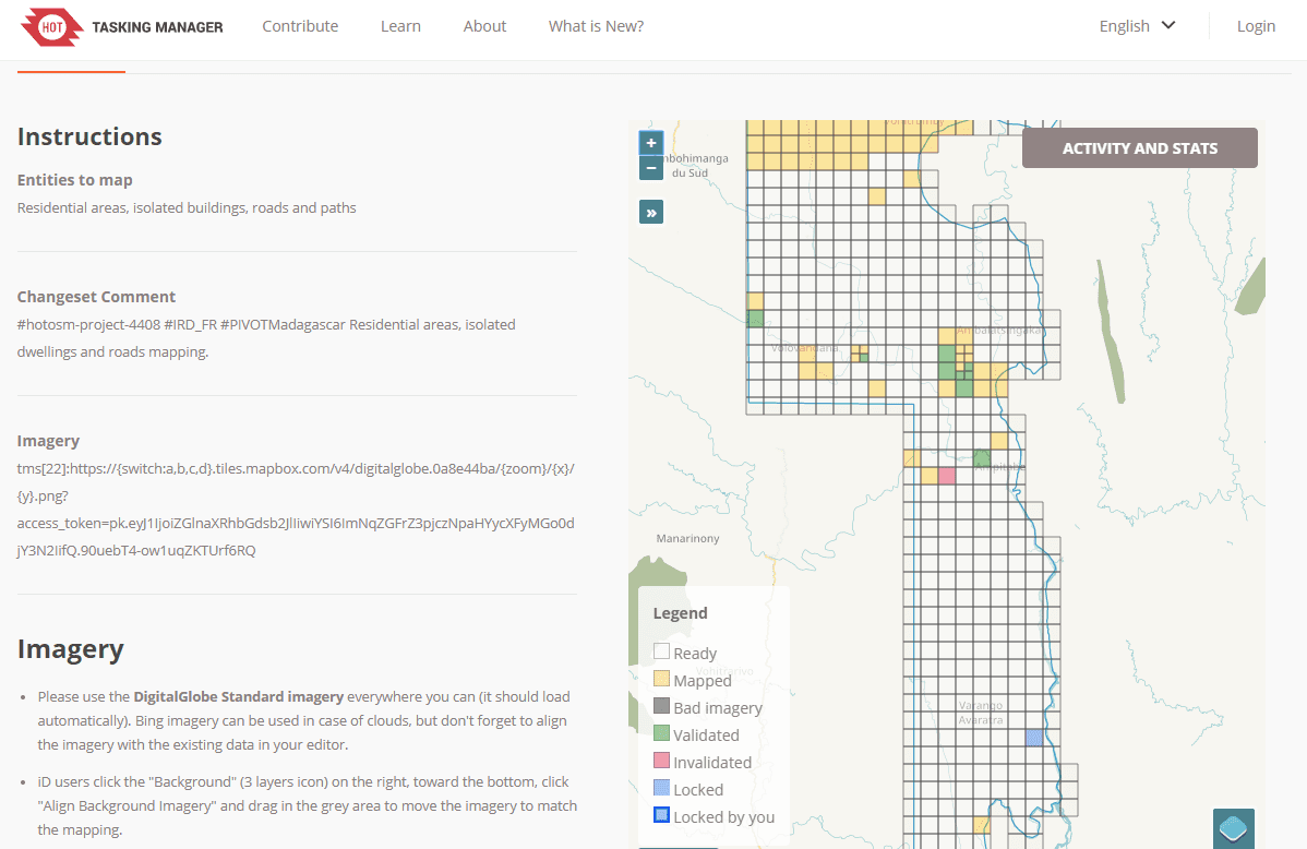
Designed and built by thinkWhere in collaboration with HOT, the Tasking Manager mapping coordination tool uses the latest in cloud architectures and open source technologies to divide a project into smaller tasks that can be completed rapidly. It not only shows which areas need to be mapped and validated, but also facilitates the simultaneous distribution of mapping tasks to the volunteer network.
The tool was developed with the support of the Australian Government via the Indonesia Disaster Management Innovation programme, the USAID GeoCenter, the World Bank via the Global Facility for Disaster Reduction and Recovery (GFDRR), the American Red Cross and the George Washington University. thinkWhere’s relationship with HOT arose as a result of its association with its charity partner MapAction, an organisation that gathers crucial data at the scene of emergencies and natural disasters and conveys it visually to first responders and relief organisations.

Benefits
Enhanced engagement and better communication with volunteer network
HOT acts as the interface between the OpenStreetMap community and relief organisations. The Tasking Manger supports the provision of remote data creation during crises, as well as the collection and organisation of existing data sources to support deployments to the field. Since its introduction, registered users have increased by 35,000 to 95,000 global volunteers.
Easier third party integration and improved work validation process
The OpenStreetMap community collection of volunteers use a variety of freely available geographic data such as aerial photography, satellite imagery and low tech field devices, including GPS, to map features and infrastructure, as well as people and events. In addition to ways to get feedback on mapping with a Questions and Answers tab, the Tasking Manager also includes dedicated Validation and Mapping tabs for the identification of new mappers.
Dramatically improves capability and helps speed the delivery of aid
To quickly provide base map data to organisations responding to a crisis, the Tasking Manager facilitates the simultaneous distribution of mapping tasks to many volunteers. It also permits prioritisation of areas and promotes quality and uniformity of the work to be done, such as the elements to be covered and the specific tags to use. Since its launch, the Tasking Manager has been used for projects around the world including cyclone Gita in Tonga, the Papua New Guinea earthquake response and flooding in South Asia.


