UN-GGIM may not be familiar to you, but it is the significantly shorter way of referring to the ‘United Nations Committee of Experts on Global Geospatial Information Management’. So, ‘GGIM’ from here on.
This article is an update on developments, but first a bit of background to set the context. GGIM was set up by the United Nations in 2011. It is ‘the apex inter-governmental mechanism for making joint decisions and setting directions with regard to the production, availability and use of geospatial information within national, regional and global policy frameworks.’ It aims to ‘address global challenges regarding the use of geospatial information, including in the development agendas, and to serve as a body for global policymaking in the field of geospatial information management’. As such it is of relevant to all of us in the GI world.
The Committee itself is the gathering of the representatives of the UN Member States and there is a whole raft of sub-committees, expert groups and working groups on topics ranging from geodesy to legal and policy issues which work throughout the year.
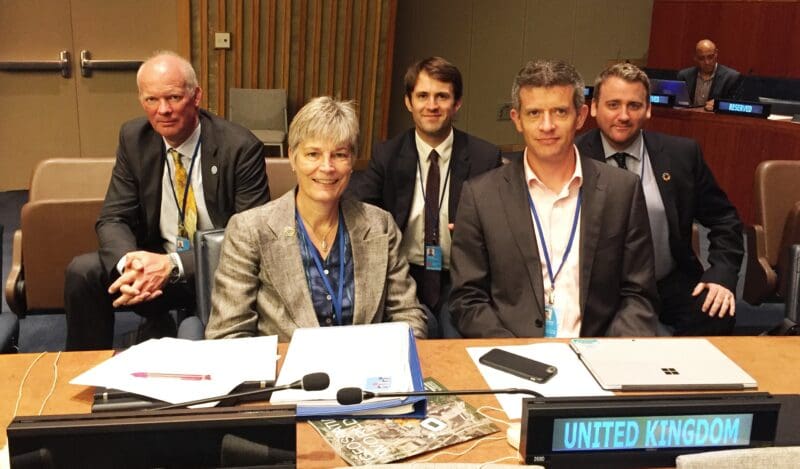
Left to right: John Kedar (Ordnance Survey), Clare Hadley (Ordnance Survey), Tim Howard (Cabinet Office), David Henderson (Ordnance Survey), and Ian Coady (Office for National Statistics)
The Committee meets once a year to consider reports and to make decisions. Most recently this happened 01 – 03 August in New York. The UK delegation is led by Ordnance Survey (of GB) and this year we had colleagues from the Cabinet Office, ONS and UKHO with us. With 20 agenda items over 3 days with 2 days of side meetings as well, it was a full-on week. As in previous years, AGI were invited to comment on the papers beforehand and contribute to the briefing for the UK delegation.
The UK is well-regarded within GGIM. We held the co-chair-ship for 4 years early in the life of the Committee, led the working group on fundamental data themes for the last 3 years and are active in several groups. We also collated and edited two editions of a publication called ‘Future Trends’.
The formal report of this year’s meeting will be published on the GGIM website in due course. There were no particularly contentious issues and the various papers and reports submitted to the Committee were endorsed. It was nice to see that the majority of our contributions during the meeting were reflected in the draft summary report.
Key developments from the meeting:
- World Geospatial Information Congress. The main ‘event’ coming up later this year is the first World Geospatial Information Congress in China. It will be an exciting event and significant in that it is the first such Congress. A number of speakers from the UK have been accepted and there will no doubt be many more attending.
- UK to host a High Level Forum. UK’s offer to host a ‘High Level Forum’ in UK in 2020 was accepted. This will be the 6th HLF and the first in Europe. It will be in April 2020 at Royal Holloway College and be back-to-back with the ‘Cambridge Conference’ which Ordnance Survey run every few years for senior staff from National Mapping and Geospatial Agencies. This will be a major event for GI in the UK that year.
- UK to revise ‘Future Trends’. UK’s offer to revise the ‘Future Trends’ document was accepted, and we were thanked. The AGI has offered to assist with this and contribute from the Foresight Report.
- Integrated Geospatial Information Framework. Last year there was an important development in that the UN signed an Agreement with the World Bank to assist countries to take practical actions to bridge the geospatial digital divide. The first deliverable of this Agreement was to be an overarching strategic policy guide and implementation reference for countries to use to develop their national action plans. So far Part 1 – the Strategic Framework – has been drafted, and Part 2 – the Implementation Guide – is in development. UK, in the shape of Peter ter Haar and John Kedar, have had significant input to these documents.
- Global Fundamental Geospatial Data Themes. UK was thanked for our leadership of the work on fundamental geospatial data themes over the past 3 years. This work in now complete and there was discussion on how to take it forward and communicate the themes
So, there is plenty going on in GGIM. In addition to the topics above UK is also active in groups on the global geodetic reference framework, integration of statistics with geospatial data, marine geospatial information, land administration and management, standards, national institutional arrangements, geographical names, geospatial information for monitoring the SDGs, and geospatial information for disasters.
If you have any queries about UN-GGIM, or would like to know more, please do get in touch.
Clare Hadley
Ordnance Survey

