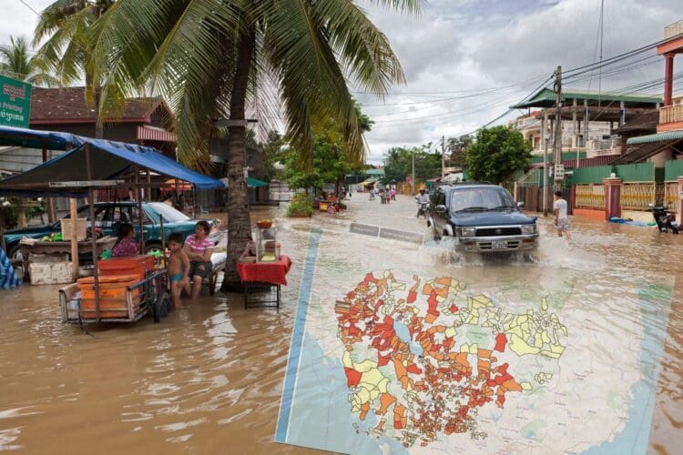
Geographic information is being used by thinkWhere to help humanitarian and government organisations visualise data about disasters to predict, prepare and respond to emergencies in Cambodia.
Challenge
With Cambodia ranked as the 9th most disaster prone country in the world and remaining one of the poorest countries in the region, its population is very vulnerable to the effects of recurrent floods, droughts and tropical storms. An easily accessible common platform, combining many different sources of information, maps and geographic data, was needed to consolidate and centralise activities between different organisations.
Solution
thinkWhere has created a Disaster Management Information System (DMIS) for the Royal Government of Cambodia. Trained staff use the online platform to centralise, visualise and interpret a wide range of data so that they can provide appropriate response recommendations.
The DMIS was developed with financial support from the German Federal Foreign Office and the United States Department of Agriculture, and on behalf of a partnership between The United Nations World Food Programme (WFP) and People in Need (PIN), a Czech-based non-profit, non-governmental humanitarian organisation.

Benefits
Enables the consolidation and centralisation of data from different sources
The DMIS uses open data and open technology to allows the storing, sharing and use of maps, geographic and other data, including the monitoring and display of live and historical disaster information. It is primarily used by the National and Provincial Departments for Disaster Management which have access to the WFP’s Platforms for Real-time Information Systems (PRISM) decision-making software which provides the ability to draw input data from various sources and output to map based platforms and dashboards.
Provides an intuitive mapping interface for data visualisation
thinkWhere developed a cloud hosted AWS (Amazon Web Services) infrastructure making the platform easy to deploy and administer. Designed as a tool for disaster scenario visualisation, it shows weather alerts, historical disaster information, information on vulnerable populations and infrastructure and real time disaster information from field staff. The system can also be used for longer term predictions informing the disaster planning process.
Integrates with existing solutions
Open source tools and technologies ensure the DMIS can be easily integrated with third party systems and data to form part of the larger overall framework of disaster management in Cambodia. The easy to use interface offers a functional and information rich mapping service that, although primarily intended for use via a laptop or desktop in an office setting, also offers full mobile functionality for use on tablets and smartphones in the field via a simple web browser.