The @geocommunity will be pleased to see OS’s work with over 1,200 users coming to fruition in the form of OS Open Zoomstack …
OS Open Zoomstack is now available as a fully-supported open data product. A round of thanks is definitely due to the 1,200 people from all parts of the @geocommunity, who took part in OS’s trials and provided feedback to the OS team. This is a welcome step towards making data more accessible.
Feedback from that trial period showed a clear preference for the GeoPackage and Vector Tile releases of OS Open Zoomstack, which are the two options being launched first. Vector Tiles (MBTiles) download as a 2.6Gb package; the GeoPackage (Zipped) package downloads as 3.8Gb – projection is the most noticeable difference is in the data schemas’ designs: the GeoPackage is in British National Grid (EPSG: 27700) whilst Vector Tiles is in Web Mercator (EPSG: 3857).
The data used in OS Open Zoomstack is available under the Open Government Licence (OGL), so this news doesn’t mean OS is releasing new data under open or free terms. However, under the OGL, you may copy, distribute and transmit the data in OS Open Zoomstack; adapt the data, and exploit the data commercially, whether by sub-licensing it, combining it with other data, or including it in your own product or application. OS asks that users acknowledge the copyright and source of the data by including the appropriate attribution statements. Read more about OS Open Zoomstack licensing here.
The geocommunity will look forward to hearing about more developments in the near future. However, we already know those developments are likely to include threshold updates; updates to the property extents; and open identifiers – all of which will be welcome. The next steps are also likely to include the release of one or more APIs, which will further increase accessiblity, but limitations aren’t known as yet and the timeline hasn’t been published.
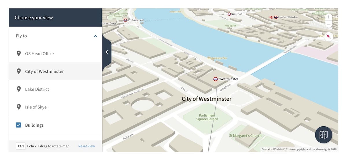
What is OS Open Zoomstack?
OS Open Zoomstack is a vector basemap of Great Britain – taking you from national to local-level zoom in one scroll of the map (or pinch of the screen). It’s highly customisable and can be used in apps, on websites, and offline. Available as one file, in two different formats, OS Open Zoomstack comes with styles, a simple data schema and guides to get you started.
- Relevant data from a GB overview to street level
- Improved, consistent cartographic styling
- Fully customisable mapping
- Supplied as a single file, updated twice yearly
- Works across multiple platforms including Mapbox, ESRI, Tableau, QGIS, Cadcorp, MapInfo, Keplr.gl, Maputnik and many more
- Easy to display third party data on the basemap
- Accurate, authoritative data
You can trial OS Open Zoomstack’s functionality here…
Disclaimer: The publication of AGI member press releases is a member service. The AGI neither approves or endorses the contents of a member’s press release, nor makes any assurance of their factual accuracy.